
Saint Vrain Blueprint | Longmont, CO
Overview
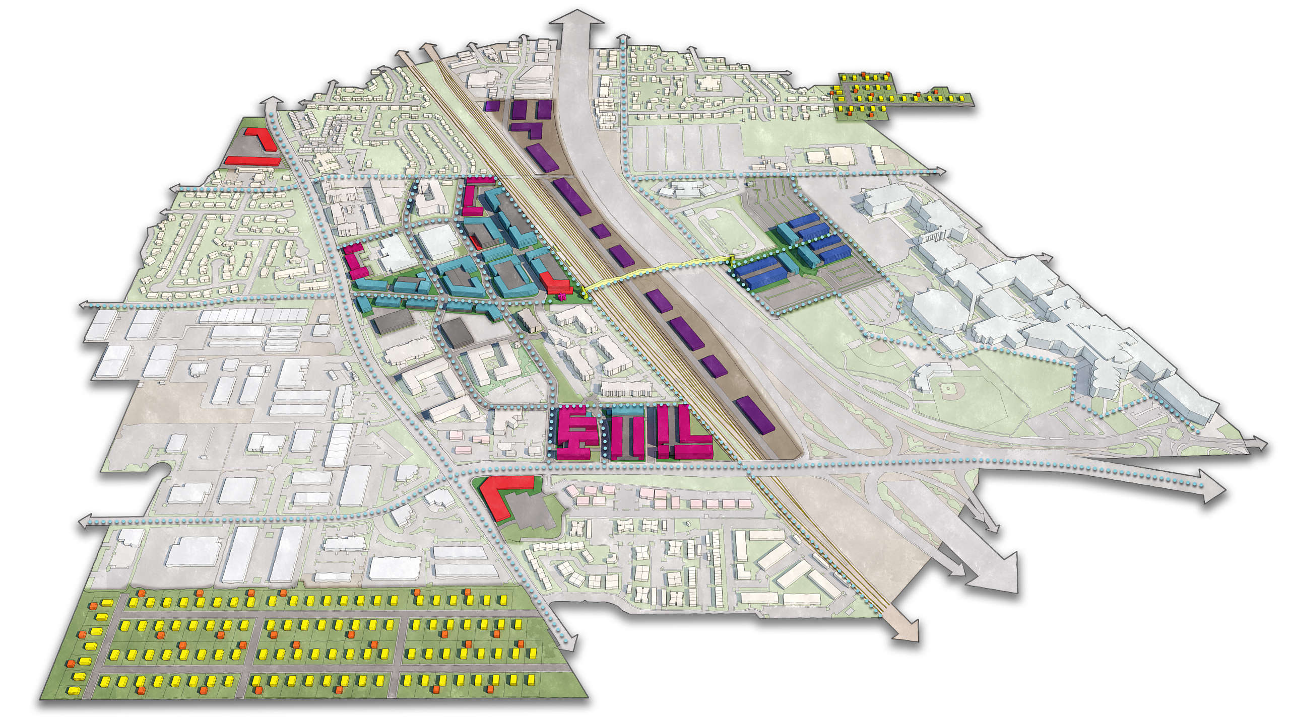
Following the devastating 2013 flood, Longmont faced a complex challenge: how to manage the St. Vrain floodplain while planning for long-term, sustainable redevelopment. Chase collaborated closely with Longmont City Staff and community members to help craft a vision that balanced ecological restoration with smart urban growth.
Through a series of interactive design charrettes, Chase facilitated collaborative sessions that brought stakeholders, city staff, and the public together from the beginning of the process. These sessions were essential in aligning the project’s vision with the community’s evolving goals, particularly as the city faced political turnover and shifting priorities due to flood recovery delays.
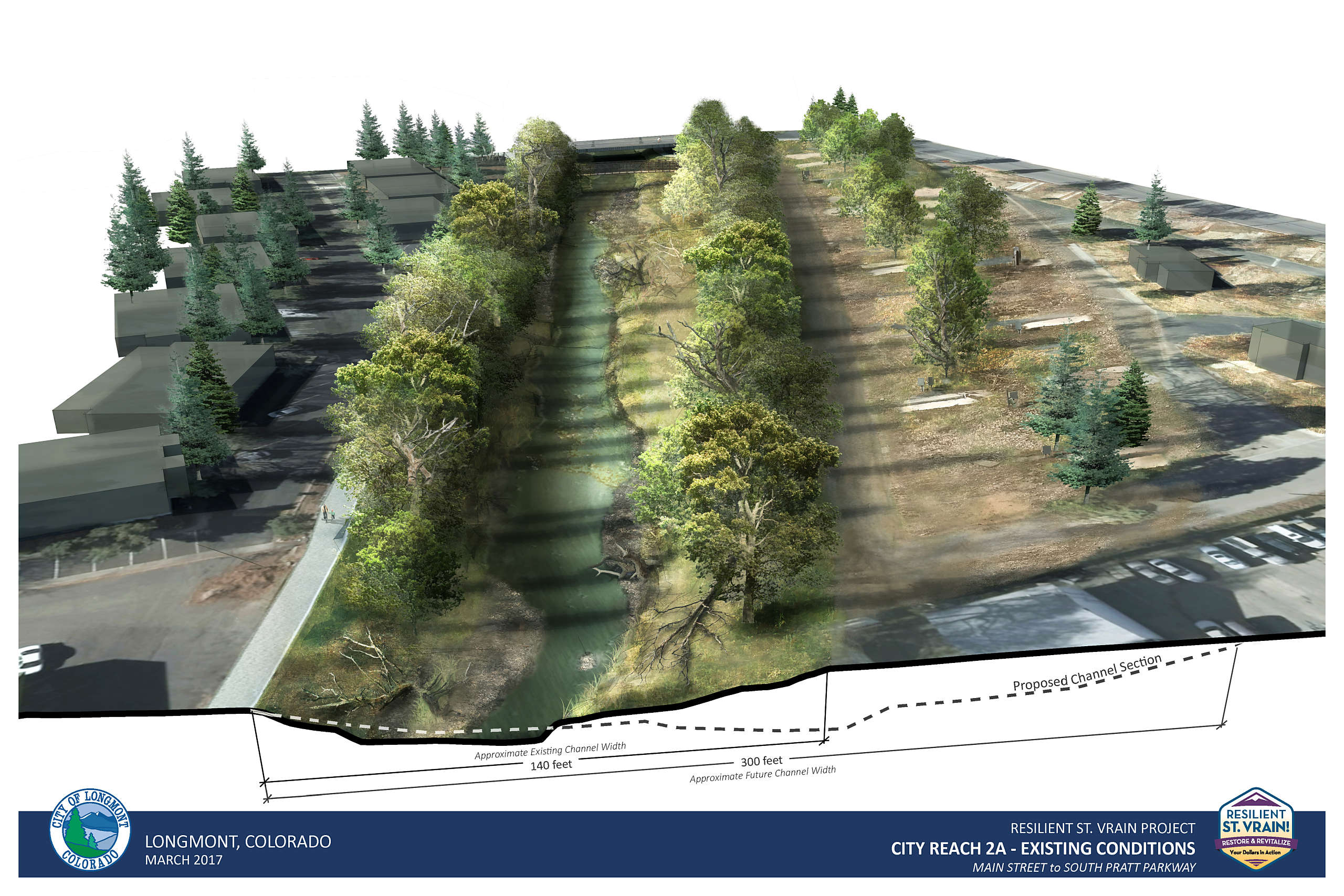
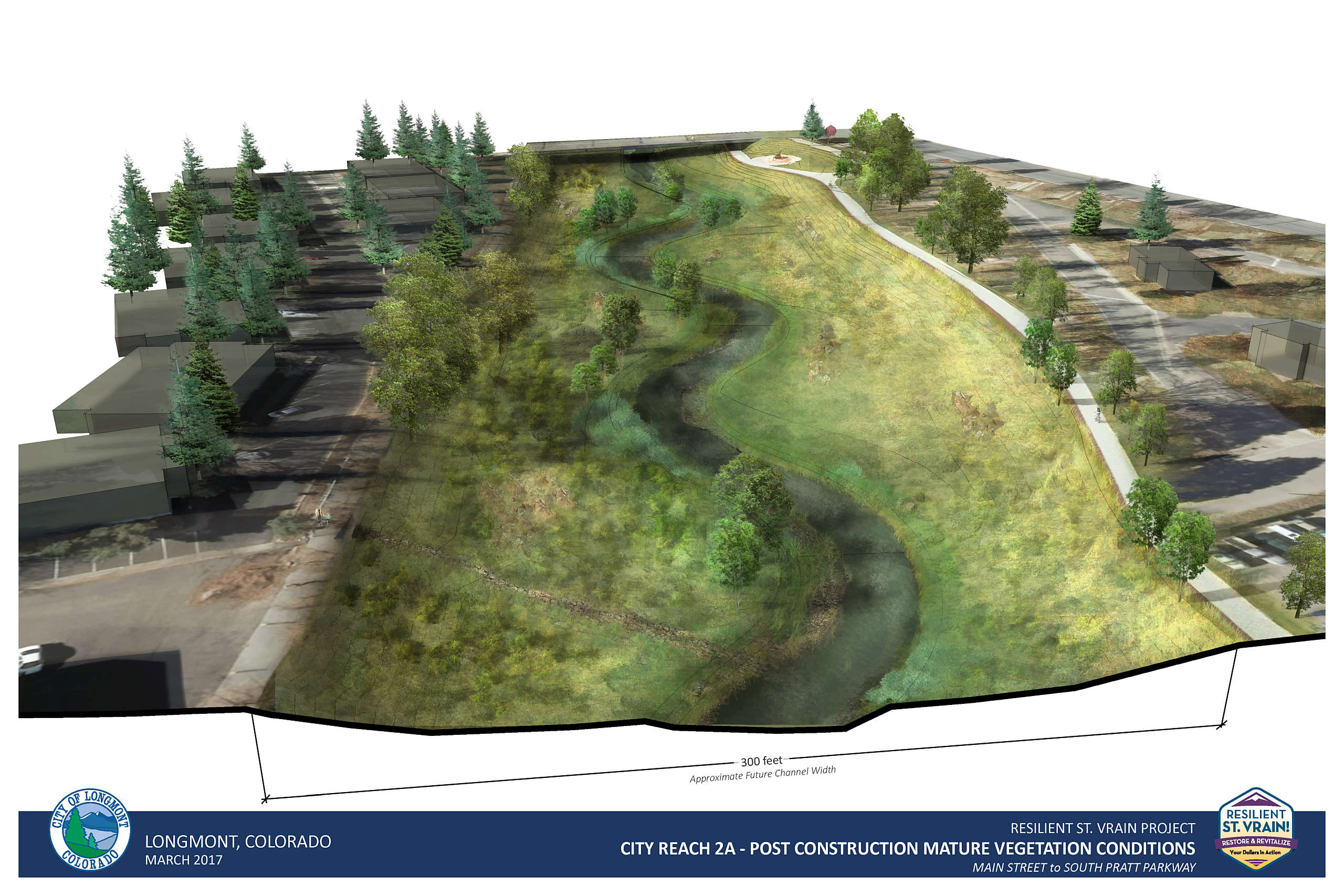
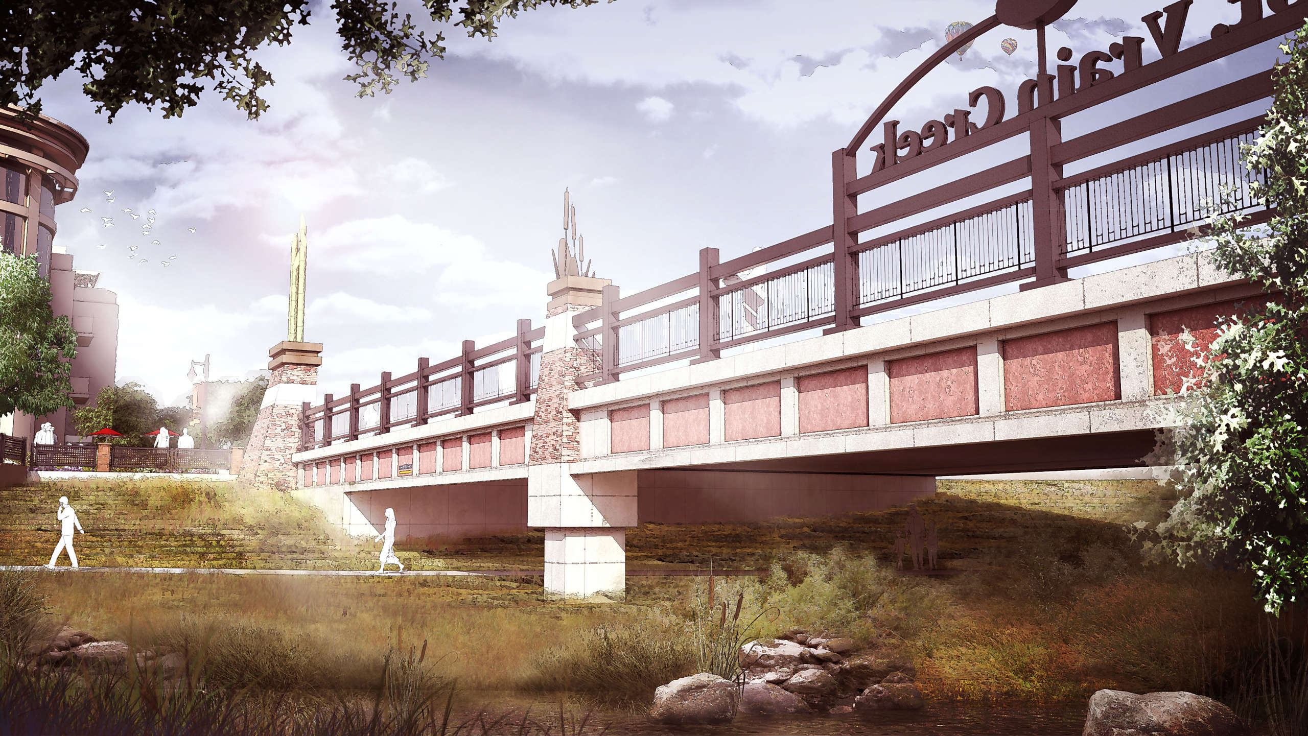
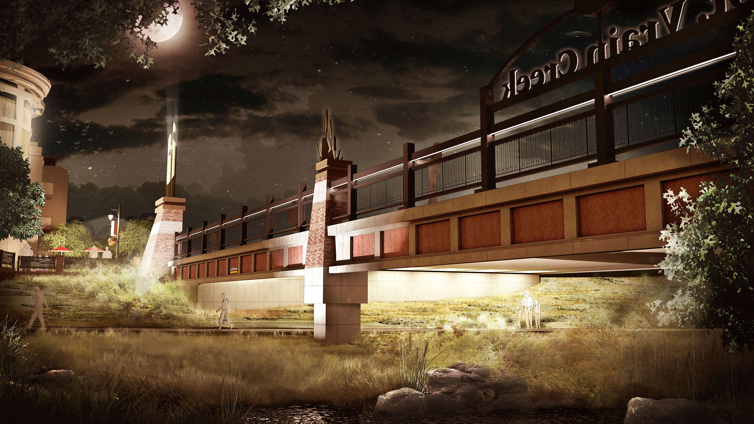
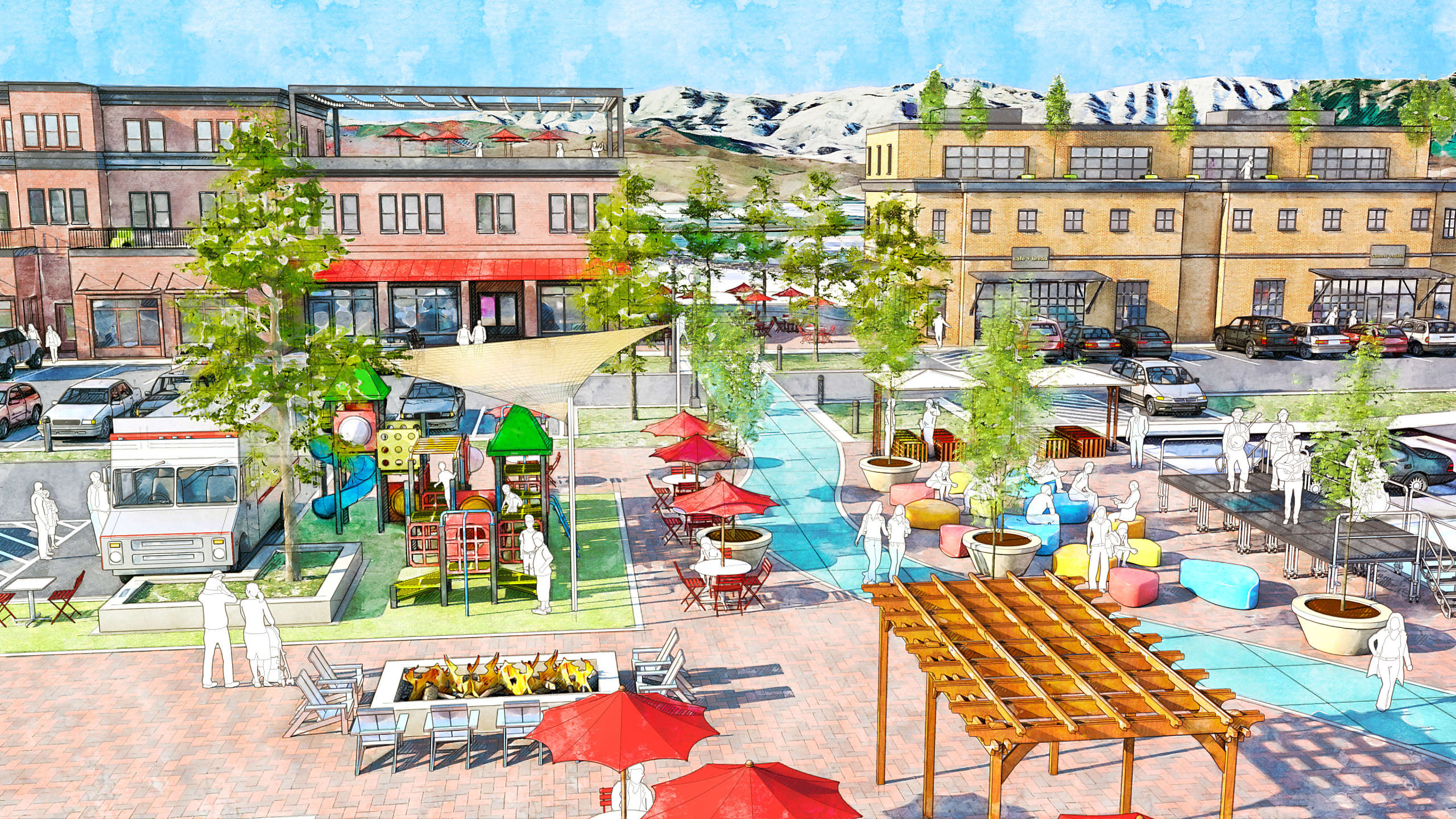
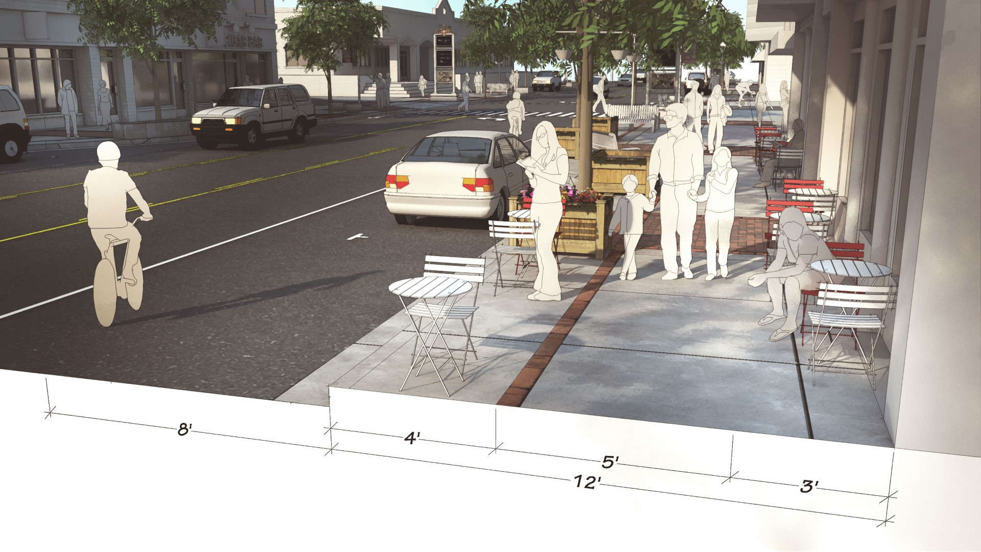
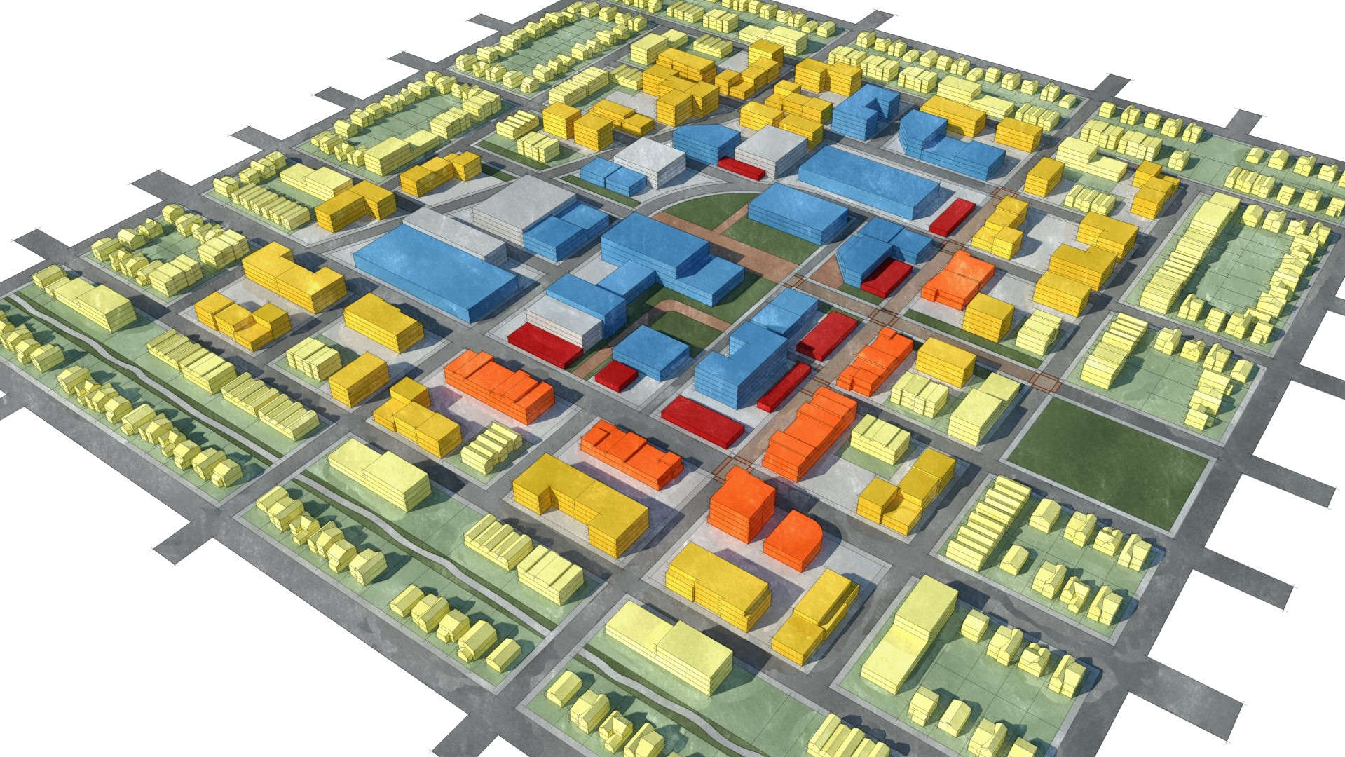
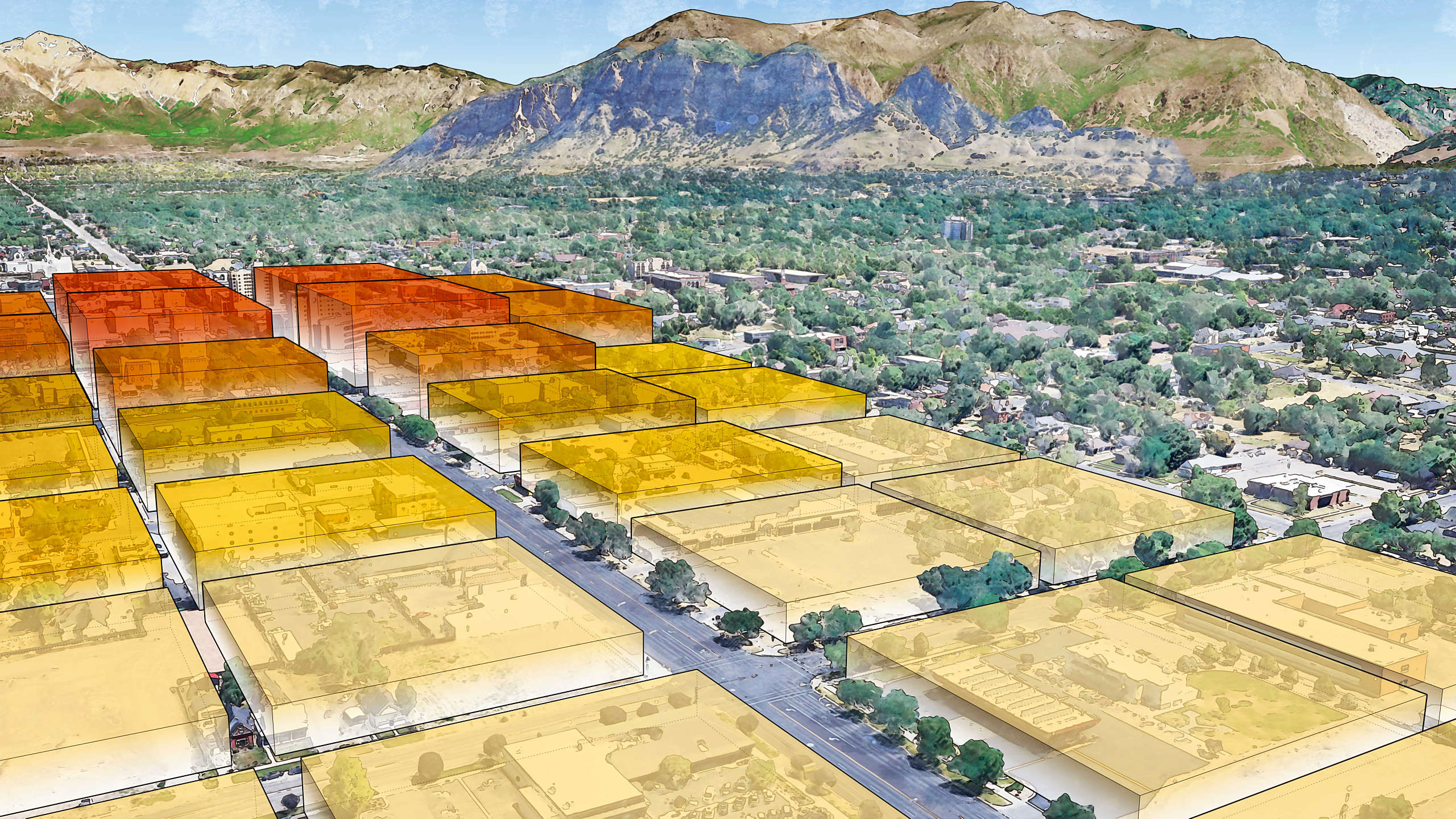
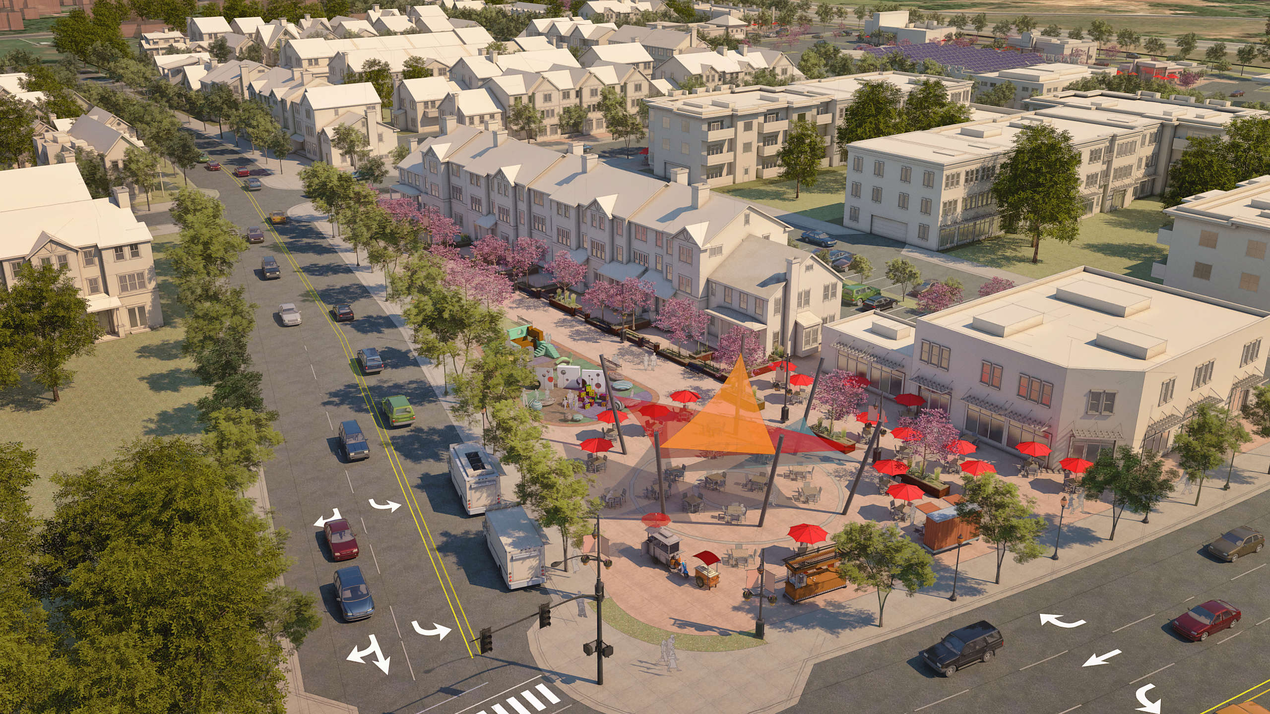
Chase’s 3D visualizations and planning diagrams played a key role in shaping policy decisions — helping residents and decision-makers understand how future development could respect the naturalized river corridor while supporting increased density, mixed-use redevelopment, and long-term economic viability. His visuals demonstrated how light industrial areas under redevelopment pressure could evolve in a way that supported both ecological preservation and urban livability.
By making abstract land use and resilience strategies tangible and accessible, the graphics helped unify the plan’s direction and maintain continuity through political change. The result was a more grounded, adaptable framework for Longmont’s future — where recovery, sustainability, and economic opportunity reinforce one another.