
Ft. Collins City Plan
Overview
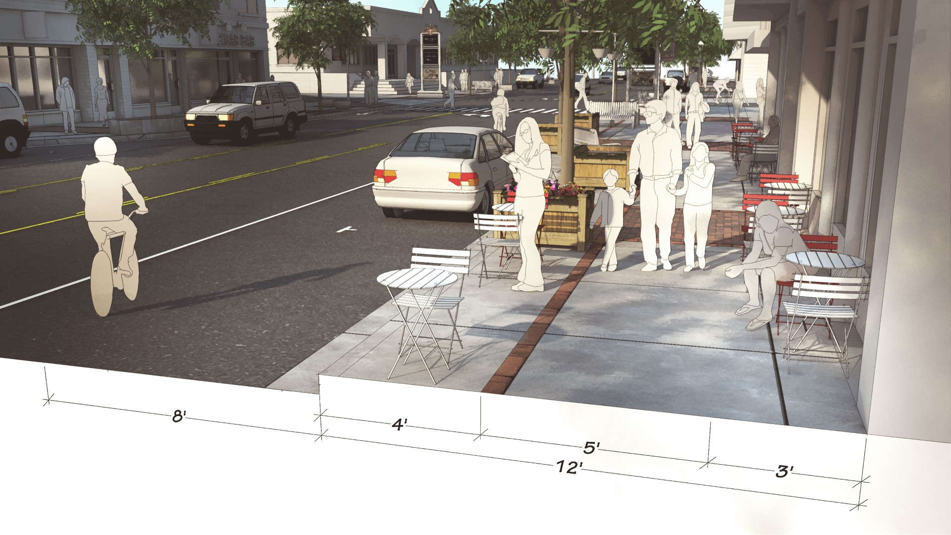
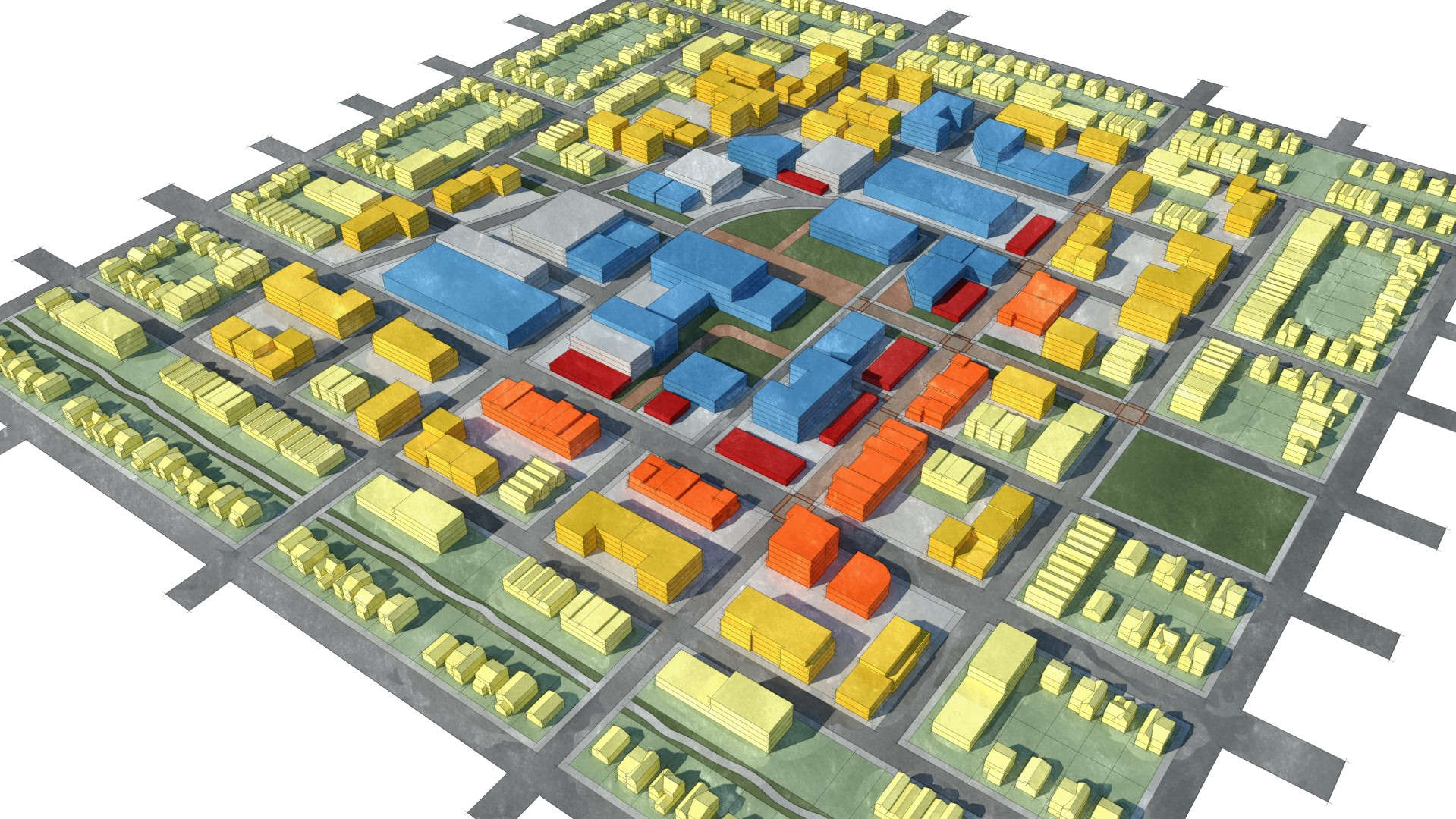
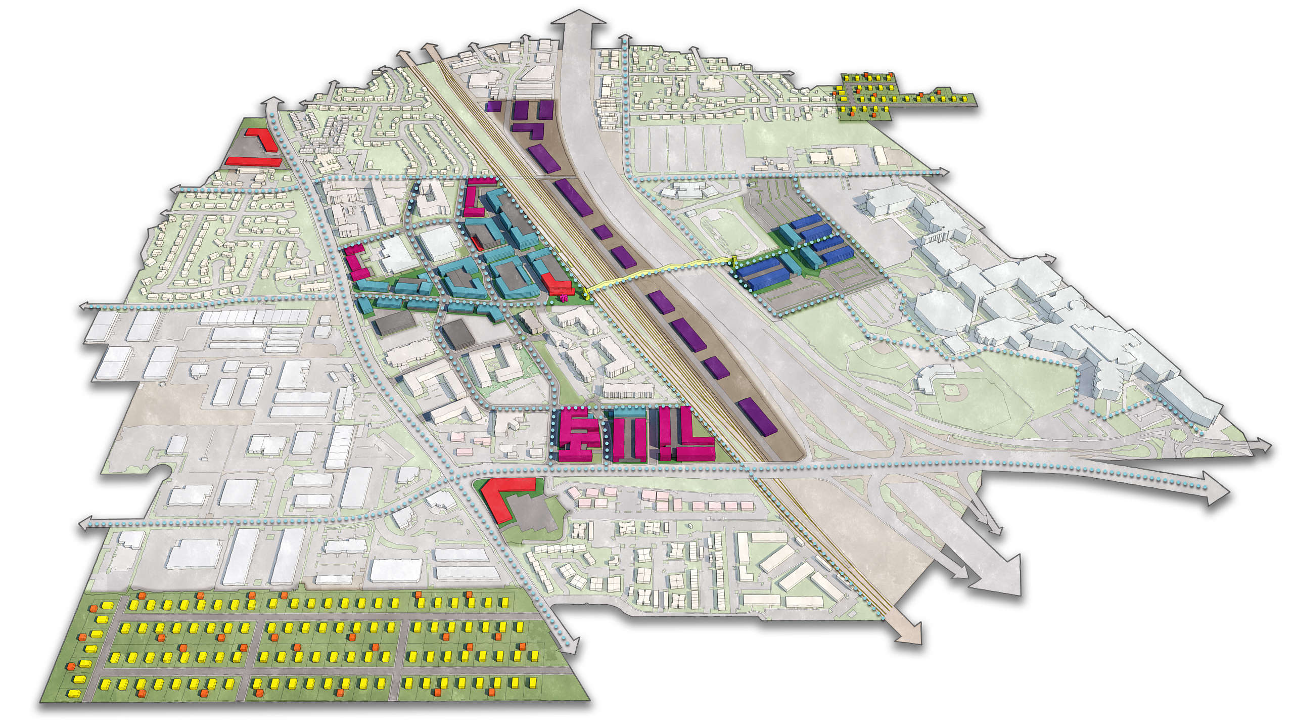
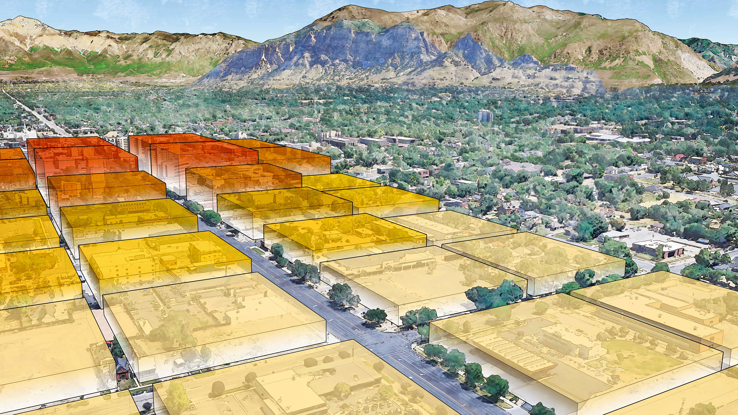
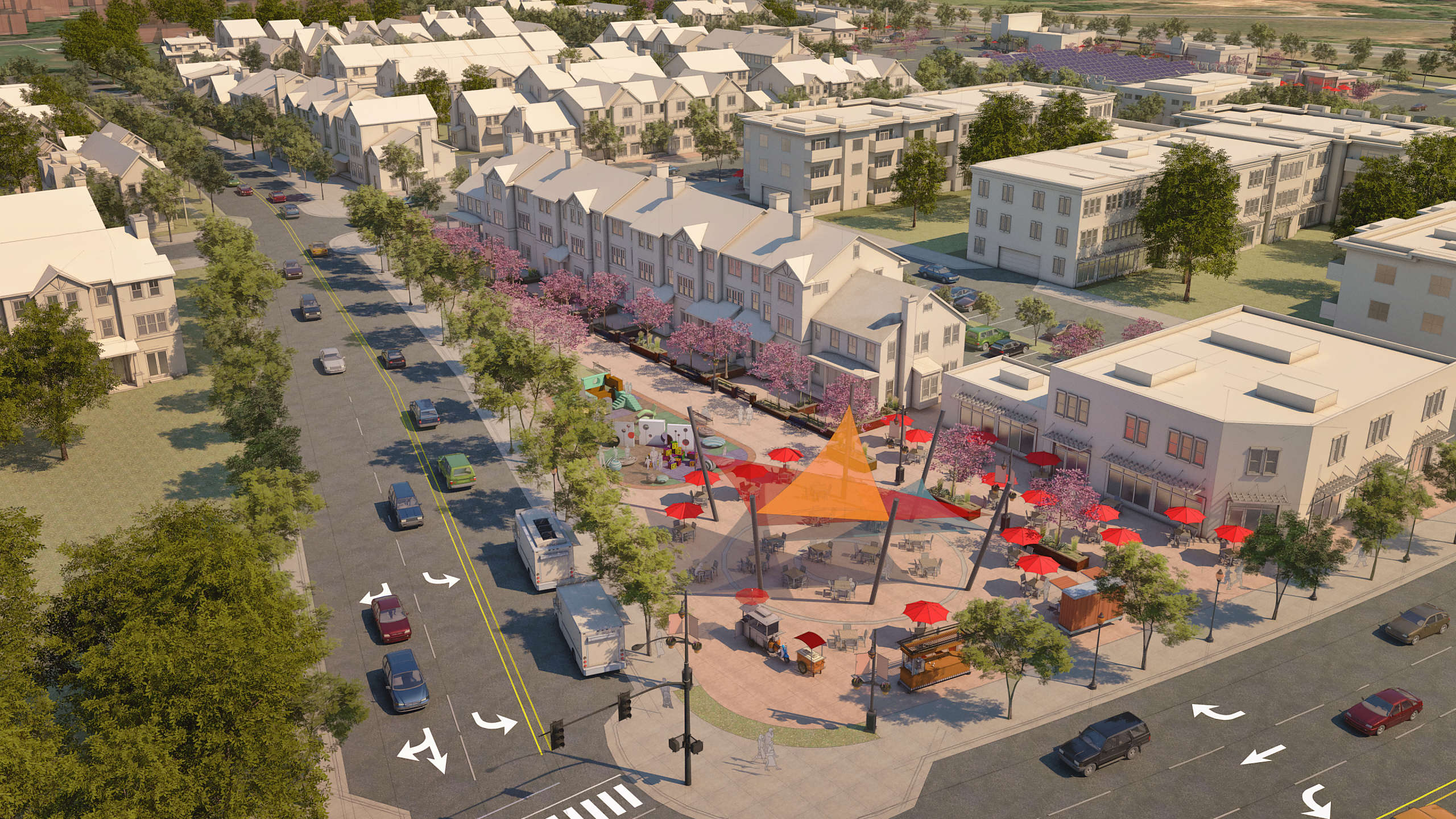
Chase played a key role in the visualization of Fort Collins’ City Plan, the community’s comprehensive blueprint for future growth, land use, and transportation. Working closely with the planning team, Chase helped craft compelling 3D graphics that illustrated how the city’s urban form can evolve to accommodate future development — while preserving the charm, character, and quality of life that make Fort Collins a desirable place to live and work.
City Plan serves as both the land use policy framework and the transportation master plan for Fort Collins, articulating the community’s vision and core values. It guides decisions on how the city will grow, where and how people will travel, and what kinds of places will be created as a result. While the plan sets a citywide framework, it is supported by more detailed neighborhood, corridor, and subarea plans, which provide additional guidance tailored to specific geographic areas.
Chase’s help brought key elements of the plan to life — illustrating how future development patterns could take shape across different contexts. His visualizations helped stakeholders and residents better understand policy concepts and design principles, building support and alignment around the city’s long-term vision.